

The maps presented below are the most current versions I've drawn for the specific provinces. All of these maps are based on the the larger maps from the 1st edition WFRP sourcebook. None have been modified since the coming of WFRP 3rd edition unless otherwise stated.
The Empire
I wanted to keep this map of the Empire relatively free from clutter. So, it only shows the four largest cities, a few of the major roads, and most of the large rivers. The purpose is to show the grand scale of the land and leave the details to the provincial maps below.
The compilation of the following maps was made challenging by the fact that there are differences between the the various maps that have been produced by Green Ronin/Black Industries since the release of WFRP2e. What makes matters worse is that the large map in "Sigmar's Heirs" often doesn't match the descriptions contained in the text. One example is the placement of Hergig which the text states is on the Wolf's Run river while the map shows it on Old Forest Road. Another example is the Moot which the map in the WFRP2e corebook and text of "Sigmar's Heirs" place where the waters of Aver Reach and Blue Reach mingle to form the River Aver (as it does in WFRP1e) as opposed to the new placement in the east. In addition, the map in Sigmar's Heirs shifted other settlements from their historic placement, such as Krugenheim. These movements, which are reflected in the gazetteers, incorrectly moved the nearby settlements, such as Kiel in Ostermark. In the maps and gazetteers that I will be uploading to this site, I will defer to the descriptions in the text of Sigmar's Heirs as these were written by the author based on the provincial boundaries that appeared on page 215 of the WFRP2e corebook. Moreover, I am using the map from WFRP1e as my base. The scale of the Empire as depicted in "Sigmar's Heirs" makes the land roughly 2/3 the size as that depicted in the original sourcebook. I prefer a larger Empire.
Hochland
The original Hochland map -- upon which this one is based -- was done with input from the Bergsburg Council. In this version, I have placed Hergig on Wolf's Run to match the text from "Sigmar's Heirs" rather than the map that appeared in that book. Moreover, I've returned Bergsburg to its proper place on the map.
Middenland
With the original Middenland map I drew, I decided that there should have a lot more settlements than seemed to be indicated by official 1st edition WFRP material. This map appeared in Strike-to-Stun #6. Like other maps, this version differs from the one in "Sigmar's Heirs". Since the town of Schoppendorf continues to get shifted around, I decided to place it back in its WFRP1e position. For those with the "Storm of Chaos" map, Schoppendorf should be place where the village of Estorf is on my Hochland map. If one prefers the map from "Sigmar's Heirs", then one could move Schoppendorf to where Harsum is located. In addition, I also stuck to the name of "Mirror Moors" rather than "Midden Moors" which is not only consistent with older WFRP maps, but also appears on the cover of "Sigmar's Heirs". UPDATE: After a long internal debate, I decided to return Delberz to its 1st edition location and changed the name of the small town from Grimminhagen to Grimminhugel to avoid consufion with the Nordlander settlement named Grimminhagen. I figured if GW could retcon Storms of Chaos out of the official setting, I could make further changes to bring the map into 1st edition compliance.
Mootland
I need to add two more bits about my placement of The Moot: (1) it is consistent with the placement shown on the cover of "Sigmar's Heirs" and (2) there is no evidence at the time that GW will go along with the change in borders that GR/BI first shifted in the GM Pack and then altered again in "Sigmar's Heirs".
Nordland
In this version, I decided to leave Salzenmund in the same location as in WFRP1e rather than move it further north on the Middenheim-Erengrad Road. Part of the reason is that was the placement I used in the maps I provided Anthony Ragan for "Sigmar's Heirs". If one prefers the location in WFRP2e, then place Salzenmund where Luftberg is situated. This version includes the locations from that GW WFB6 campaign as well as many of those detailed in Tim Eccles' "A Private War". There are also locations from the "Sea of Claws" article written by Ryan Wileman for Warpstone and from a scenario printed in that same fanzine.
Ostermark
Despite the movement of some settlements from Ostermark to the Talabecland gazetteer by GR/BI, I have returned some of the settlements Tim Eccles described in his "A Private War: Homeward Bound" back to Ostermark.
Ostland
Ferlangen was moved further south as indicated by "Storms of Chaos". This version includes the locations from that GW WFB6 campaign as well as many of those detailed in "A Private War" and Ryan Wileman's article.
Reikland
In the original map, I had some help from Arne Dam in placing the towns described in GW's "Wine of Dreams" novel. This map appeared in Strike-to-Stun #6.
Stirland
This map includes locations described in "Monastic Orders in the Old World," written by the Server Goddess. It actually covers western & central Stirland in order to give myself more room to detail more locations.
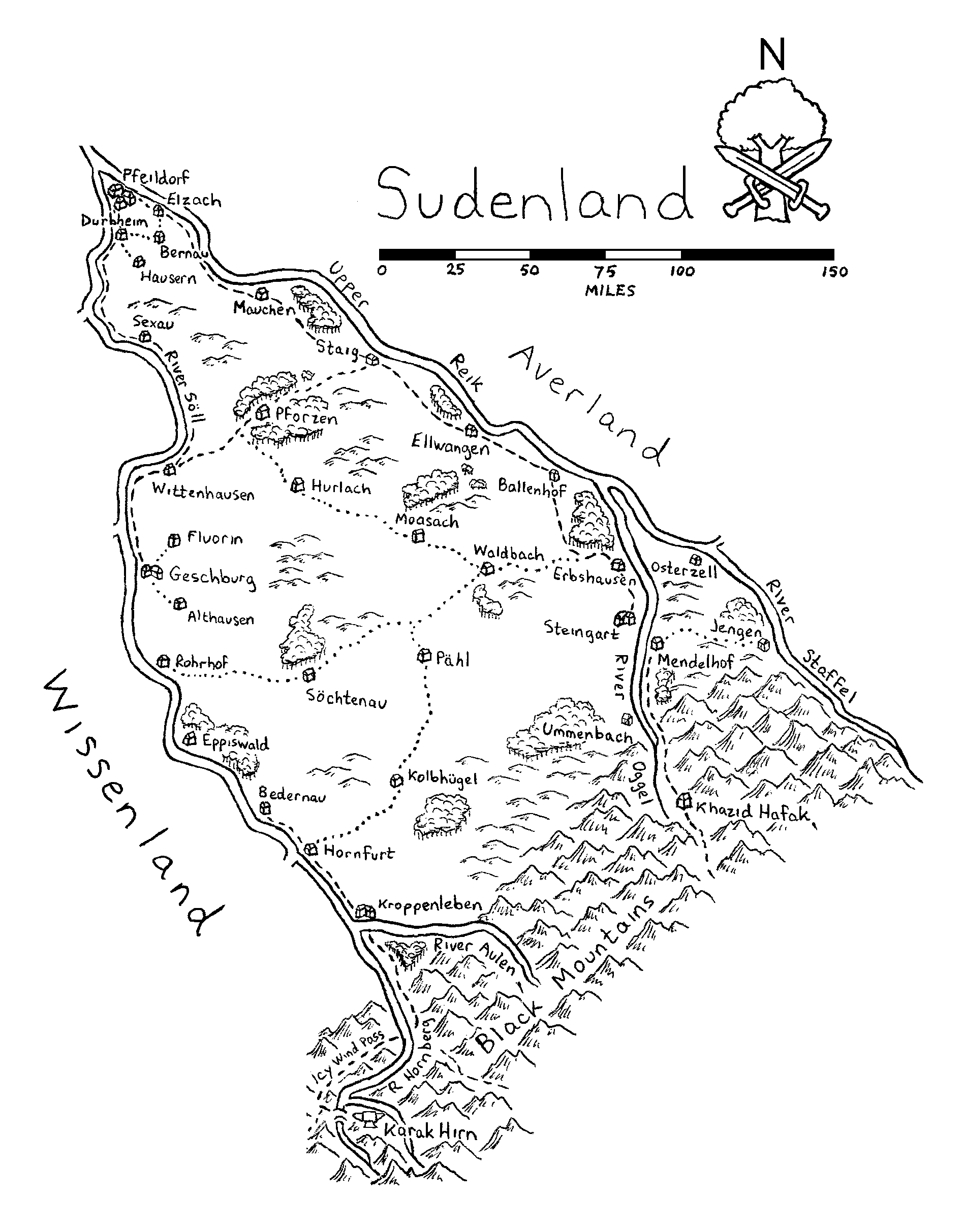
Sudenland
Well, technically, Sudenland only exists as the part of Wissenland east of the River Soll in WFRP2e. Still, I've included it here for those GMs that prefer a free Sudenland. There's even a gazetteer for it below.
Sylvania
Or, more properly referred to as Eastern Stirland. This version replaces what was drawn for use in Strike to Stun #3. The original map was not done in the same scale as the other maps, so I decided to redo the map of Sylvania to be consistent. Revised 8 Dec 2022 as I found out that I used an entirely incorrect scale. Now corrected.
Talabecland
In making this map, I incorporated a number of locations from various scenarios that appeared in Warpstone fanzine.
Revised 25 June 2020: Had the village name of Tauer appear on both maps of Talabecland and Ostermark. Tauer shows up in a WFRP2 book in Ostermark, so I changed the village name in Talabecland to clear up any confusion.
Wissenland
This is the Wissenland of 1st edition WFRP. In addition, I've added some of the nearby Dwarf settlements in the Grey Mountains.