

Streissen
This map of Averland's second largest town was created for the Streissen/ West Aver Valley sourcebook, which can be found at the Article: Sourcebooks and Guidebooks page (along with the keyed map).
Marburg
Developed for the 2018-2020 campaign I'm running, this map of the small Stirland town (large village?) of Marburg in northeastern Stirland includes a key for some of the locations therein. This map is included in the Hundsheimer Wald guidebook (found at Article: Sourcebooks and Guidebooks).
Marburg area
This map was developed for the 2018-2020 campaign I am running. It details the immediate area around the Stirlander town of Marburg.
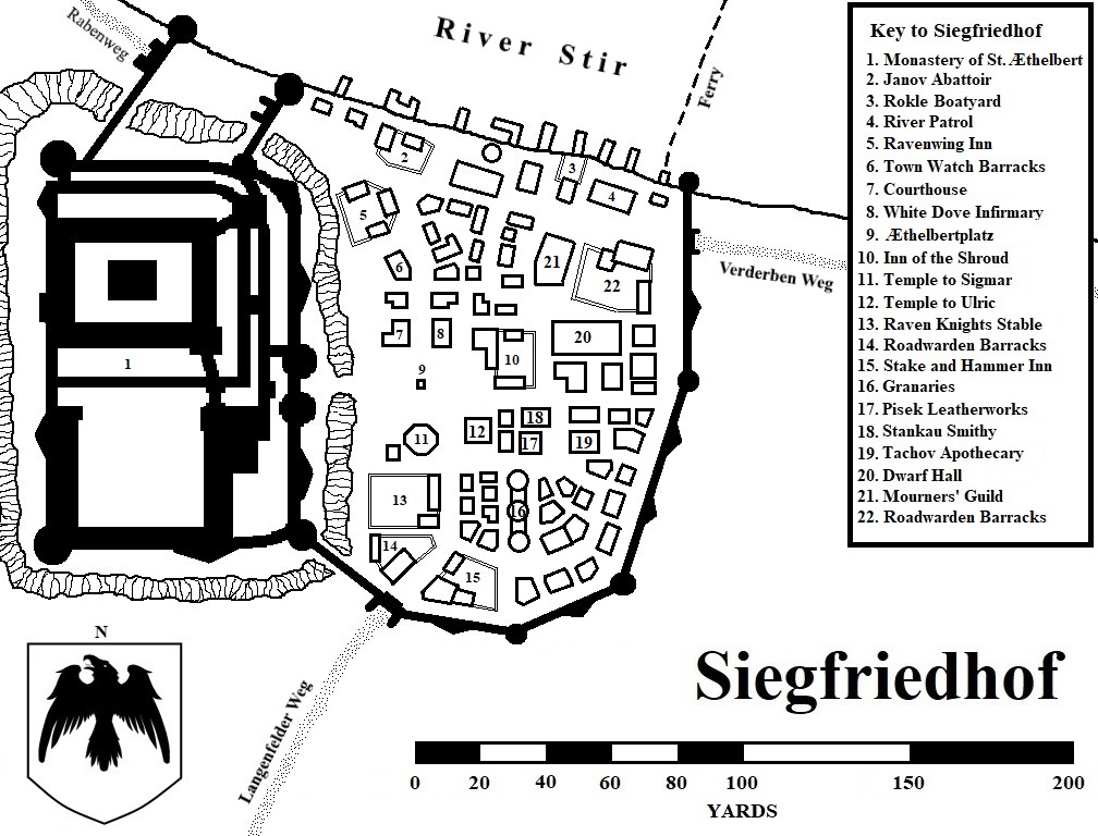
Siegfriedhof
Developed for the 2020-2021 campaign I'm running, this map of the small fortified town of Siegfriedhof in northeastern Stirland includes a key for some of the locations within the Raven Knight stronghold.
Thalheim
Developed for the 2018-2020 campaign I'm running, this map of the small fortified Stirland village of Thalheim in northeastern Stirland includes a key for some of the locations therein. This map is included in the Hundsheimer Wald guidebook (found at Article: Sourcebooks and Guidebooks).
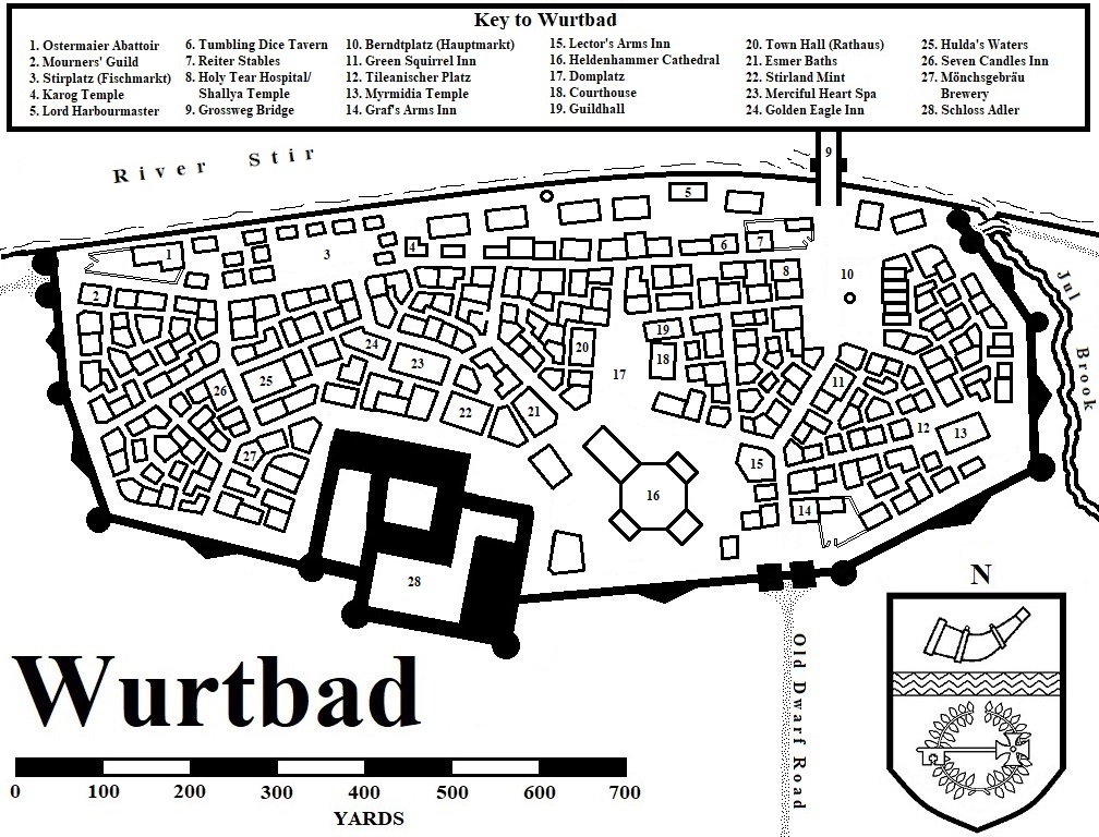
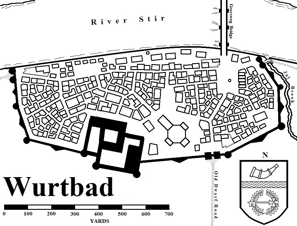
Wurtbad
Although not developed for my 2018-2022 campaign, I drew this map of the town of Wurtbad as a few of my players visited the Stirland capital for one reason or another. I know there are other versions of Wurtbad on the internet, but that doesn't stop me from creating and sharing my own. A clean Wurtbad map is also included for GMs to hand newly arrived players.
Updated 16 February 2025. Changed the names of some of the establishments in Wurtbad and added a new location.
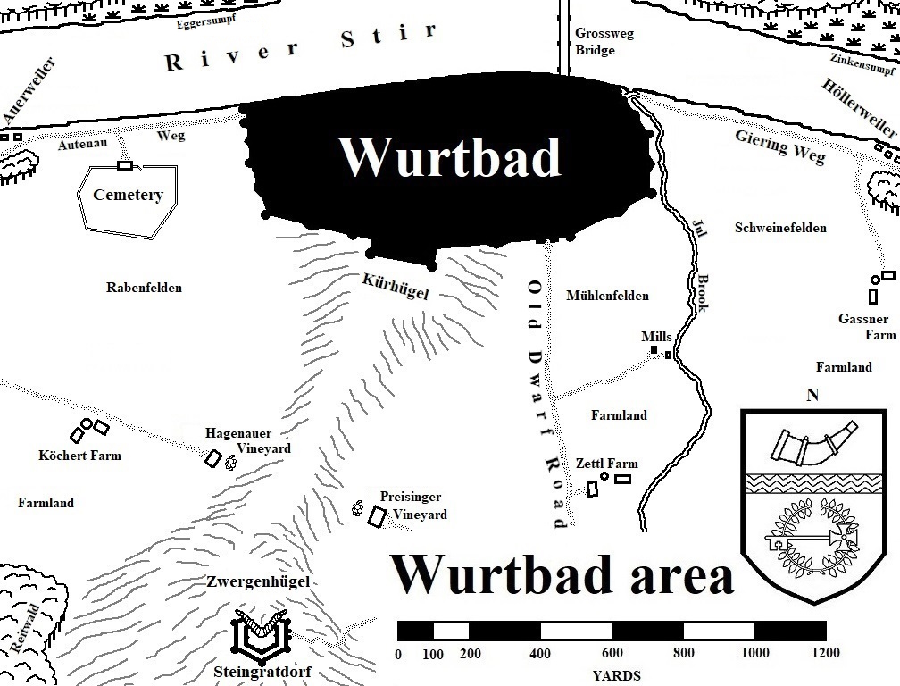
Wurtbad area
This map shows the immediate area around Wurtbad.
Updated 28 September 2024. Corrected/changed the names of the fields surrounding Wurtbad.
Updated 16 February 2025. Corrected/changed the names of some of the geographic features on the map as well as a town name.
Pfeildorf
This map was developed for the Pfeildorf sourcebook(found at Article: Sourcebooks and Guidebooks). This version does not include numbers or letters to designate location descriptions. The detailed map and key appears in the Pfeildorf sourcebook.
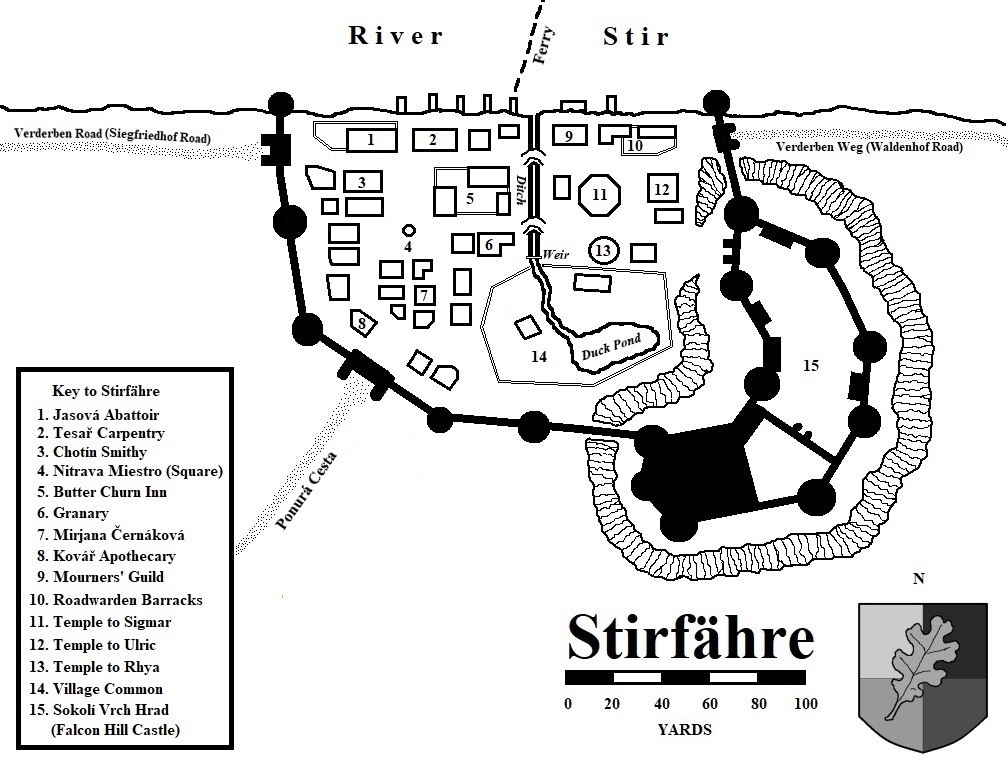
Stirfähre
Developed for the 2020-2021 campaign I'm running, this map of the small fortified village of Stirfähre in northwestern Sylvania includes a key for some of the locations within the seat of the Barony of Nitrava. Revised 12 April 2023 to change the name of a road.
Gersdorf
Developed for the 2018-2020 campaign I'm running, this map of the Talabeclander town of Gersdorf in southeastern Stirland includes a key for some of the locations therein. This map is included in the Hundsheimer Wald guidebook (found at Article: Sourcebooks and Guidebooks).
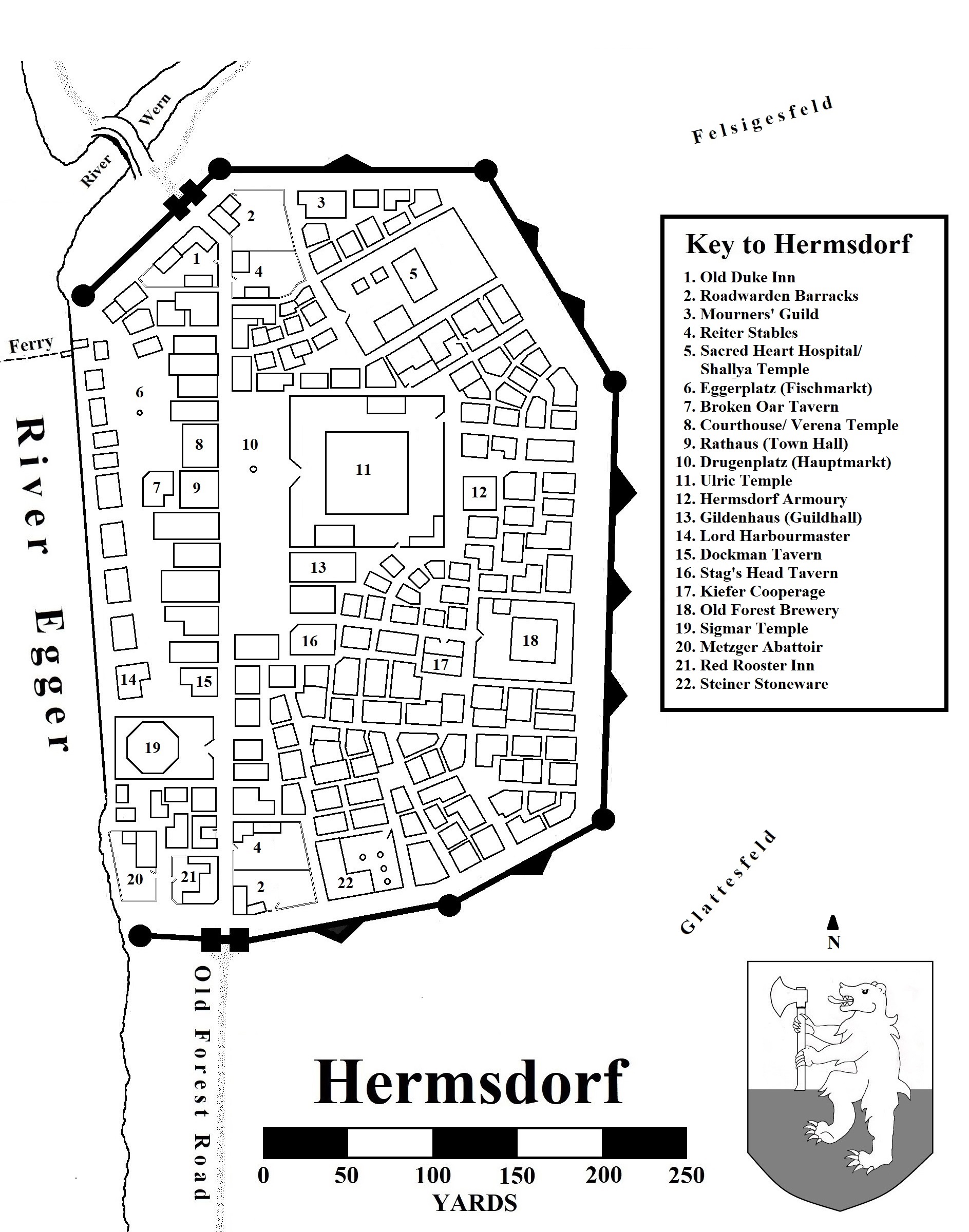
Hermsdorf
I did not complete the map Of Hermsdorf, the largest town in the Egger River Valley in time for the 2018-2022 WFRP campaign I ran. It's the first of a number I now have time to draw.
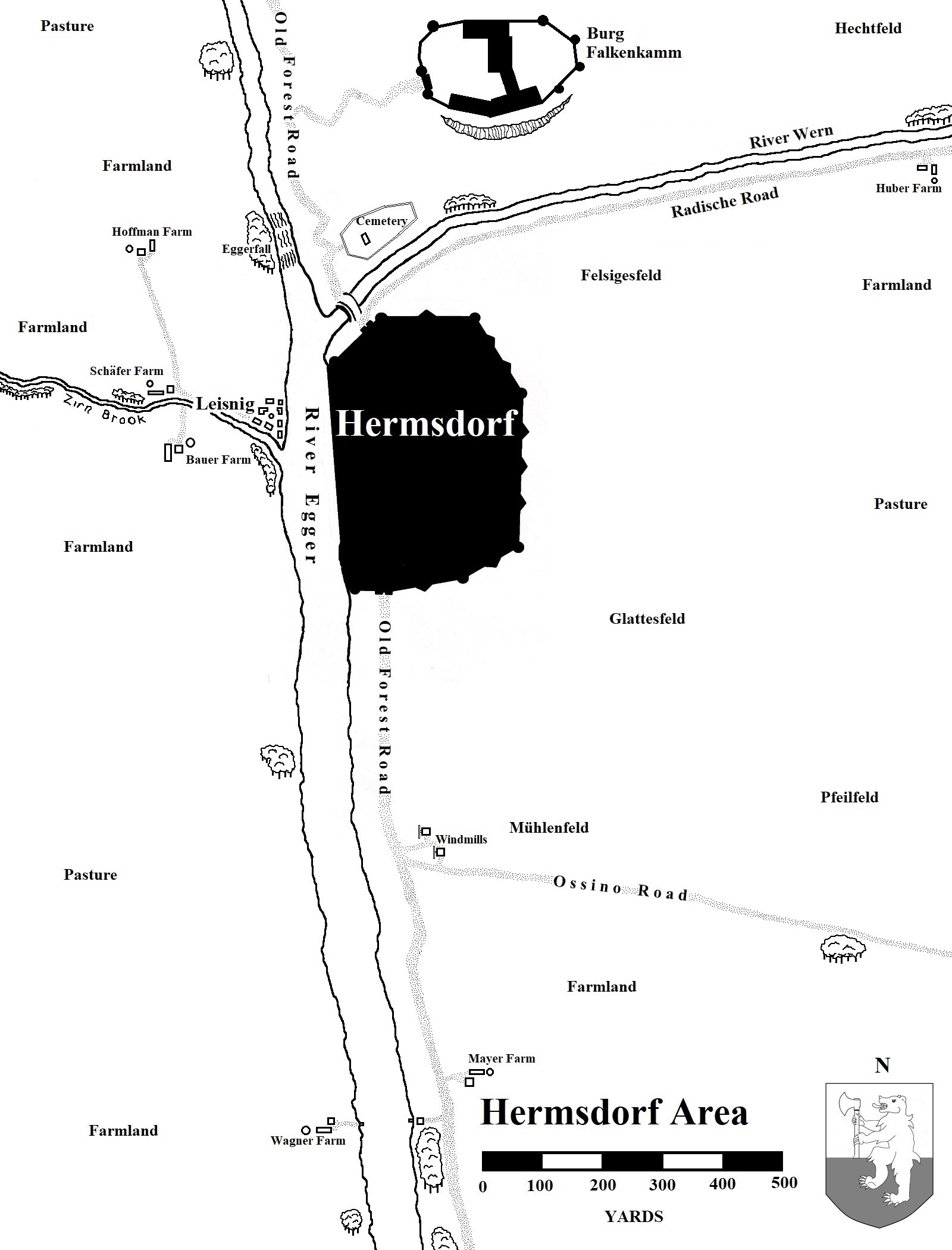
Hermsdorf area
This map was developed for the 2018-2022 campaign I ran and detailed the immediate area around the Talabeclander town of Hermsdorf in the Egger River valley.
Revised 1 January 2024. Added some more details to the area map.
Revised 10 April 2024. Changed the name of castle outside Hermsdorf from Schloss to Burg.
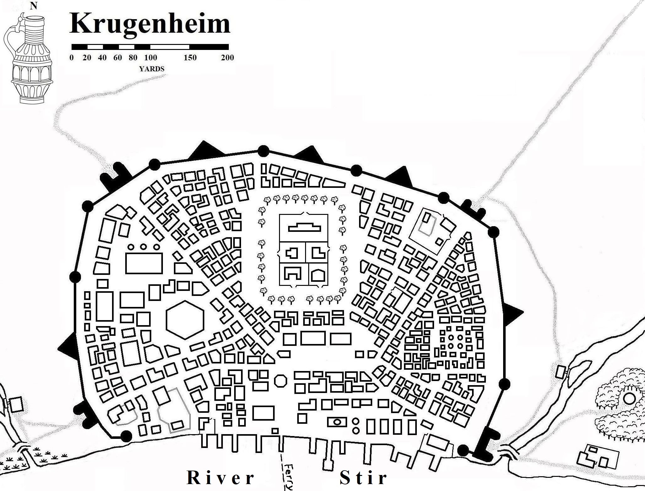
Krugenheim
Also developed for the 2018-2020 campaign I'm running, this map of the Talabeclander town of Krugenheim in southeastern Talabecland includes a key for some of the locations therein. This map is included in the Hundsheimer Wald guidebook (found at Article: Sourcebooks and Guidebooks). I also have a "clean copy" (without the locations) of the map available.
Krugenheim area
This map was developed for the 2018-2022 campaign I am running and details the immediate area around the Talabeclander town of Krugenheim, near the border with Ostermark.
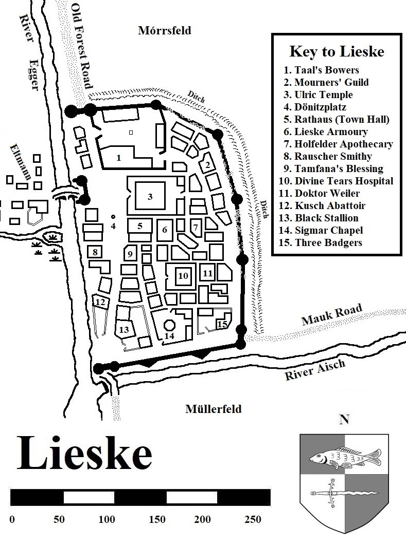
Lieske
Another of the maps I did not complete in my 2018-2022 WFRP campaign was that of Lieske, which is located in the Egger River Valley to the north of Hermsdorf. So, this makes settlement map number two.
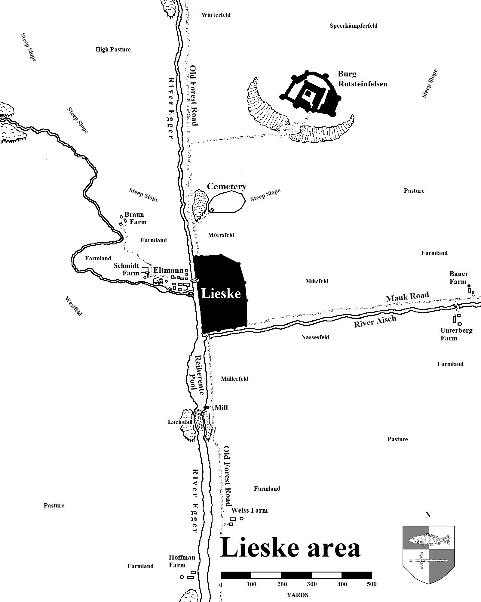
Lieske area
This map was developed for the 2018-2022 campaign I am running and details the immediate area around the Talabeclander town of Lieske in the Egger River valley.
Revised 1 January 2024. Added some more details to the area map.
Revised 10 April 2024. Changed the name of castle outside Lieske from Schloss to Burg.
The four largest cities have publsihed maps in either 1st or 2nd edition. The only city map I "enhanced" is as follows:
Altdorf
The Key to this map can be found at the Article: Sourcebooks and Guidebooks page. I drew this map at the time when Altdorf did not have a proper sourcebook. Green Ronin pitched this version for their Spires of Altdorf without giving me an acknowledgment. Poor form, really. At any rate, Cubicle 7 has an Altdorf sourcebook that renders this map obsolete.